 In 1959 and 1960, our predecessor, the Arizona
Bureau of Mines at the University of Arizona, published the Arizona County Geologic
map series. Until now, these important maps were only available in printed
form. We are going digital.
We've published the entire series of
county maps online, starting with Apache and Navajo counties. All maps are available free at the AZGS
online document repository. The map scale is 1:375,000 and the contour interval
is 500 feet. It is posted at http://repository.azgs.az.gov/uri_gin/azgs/dlio/1618.
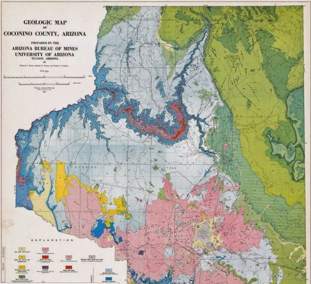
The Coconino County map is at http://repository.azgs.az.gov/uri_gin/azgs/dlio/1620. Coconino County is situated in northern Arizona and encompasses, Grand Canyon, the San Francisco volcanic field, part of the Colorado Plateau, and the Arizona Strip.
The Coconino County map is at http://repository.azgs.az.gov/uri_gin/azgs/dlio/1620. Coconino County is situated in northern Arizona and encompasses, Grand Canyon, the San Francisco volcanic field, part of the Colorado Plateau, and the Arizona Strip.
Released to date:
Apache and Navajo Counties (one map)
Coconino County
Cochise County
Gila County
Graham and Greenlee Counties
Maricopa County
Mohave County
Pima and Santa Cruz Counties
Pinal County
Yavapai County
Yuma County
[updated from the AZGS announcement]
Yuma County
[updated from the AZGS announcement]

No comments:
Post a Comment